
Palm Desert ZIP Areas
USPS postal codes route mail, while Palm Desert city limits, Riverside County parcels, and named communities follow other systems. The research establishes 92260 and 92211 as core Palm Desert delivery codes. It places 92210 near Indian Wells and the southeast edge, where the exact address must be checked before a Palm Desert label is assumed. The table distinguishes documented relationships from an unverified station or boundary.
| ZIP | Areas covered or relationship | Post office or station | Notes |
|---|---|---|---|
| 92260 | Central and southern Palm Desert, including City Hall, El Paseo, and Portola-area examples | Palm Desert Post Office, 74801 Hovley Lane E; Portola station, 45300 Portola Avenue | Main Palm Desert city-name ZIP in the inspected official usage |
| 92211 | North and east Palm Desert, including the Country Club Drive corridor and areas toward I-10 | Current USPS facility was not confirmed in the assigned inspection | Verify each address and city boundary separately |
| 92210 | Indian Wells and border-area mail geography southeast of Palm Desert | Station record was not confirmed in the assigned inspection | Do not call it a Palm Desert city ZIP without USPS and GIS checks |
| Other codes | 92255 and 92261 were not established by the assigned official sources | Not confirmed | Do not infer from a commercial ZIP list |
A postal preferred city and an incorporated city can overlap without matching. That is why a Palm Desert ZIP code directory must lead to an exact-address test instead of a citywide claim.
Verify One Palm Desert ZIP with USPS
The USPS address lookup is the authoritative address-level postal check documented in the research. Its by-address form asks for a street address, apartment or suite when needed, city, state, and an optional known ZIP. The returned standardized address and ZIP should be saved with the date of the check. USPS answers delivery geography, not ownership, occupancy, parcel shape, or city incorporation.
| USPS field | Use in a Palm Desert ZIP search |
|---|---|
| Street address | Enter the deliverable street number and street name. |
| Apartment, suite, or other | Add the unit line when the address has one. |
| City and state | Use Palm Desert and California when those are the supplied postal labels. |
| Known ZIP | Optional comparison field that can test a suspected code. |
The USPS address lookup is the source for the form shown below.
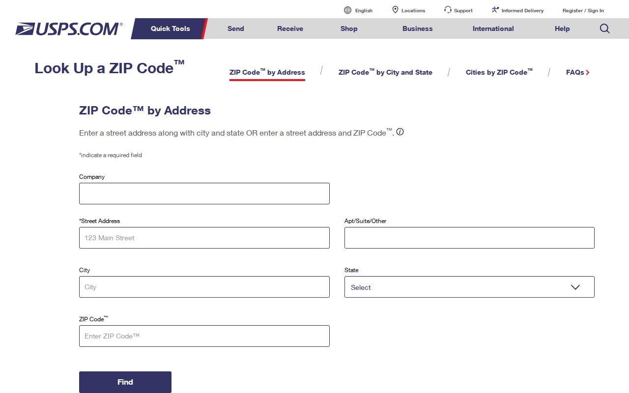
The postal result should be kept separate from the parcel and city-limit checks that follow.
Palm Desert ZIP Code Directory Limits
A ZIP groups delivery points. It does not identify everyone at those points, show all parcels inside a boundary, or reveal which person receives mail. A ZIP search also cannot show household members, private association rosters, protected voters, utility customers, or the person who owns a parcel. Those facts belong to different custodians and often have different legal limits.
For a Palm Desert resident question, use a ZIP only as a first geography clue. Move to the assessor or GIS for a parcel, to the recorder for a name-keyed instrument, to the court for a case, or to an archive for an old household. The directory keeps the search from drifting into a nearby city, but it does not answer the person question by itself.
Two separate answers. USPS decides where an address is delivered. Riverside GIS and Palm Desert maps help decide which parcel and municipal geography the address belongs to.
Palm Desert ZIP 92260 Geography
92260 is the clearest Palm Desert city-name ZIP in the inspected records. City Hall uses 73510 Fred Waring Drive, Palm Desert, CA 92260. USPS lists the Palm Desert Post Office at 74801 Hovley Lane E, Palm Desert, CA 92260-9998, and a Portola station at 45300 Portola Avenue, Palm Desert, CA 92260-9996. Those facility records establish postal service points, not a polygon boundary or a full list of addresses.
Central and southern Palm Desert examples, including the El Paseo and Portola areas, often use 92260. Still, a parcel search should retain the street address and APN. A ZIP line can be copied wrong, changed by USPS, or used by a nearby organization that serves more than one city.
The USPS Palm Desert Post Office listing is the source for the facility information used here.
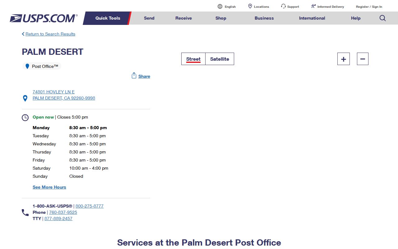
The post-office listing confirms a delivery facility, while the USPS address tool confirms the ZIP for a particular location.
Palm Desert ZIP 92211 Geography
Public agency addresses use 92211 for north and east Palm Desert, including the Country Club Drive corridor and communities toward Interstate 10. The assigned research did not confirm a current USPS facility attached to 92211, so a facility name should not be invented. The right check is the exact address in USPS ZIP Lookup, followed by Riverside GIS when a city or parcel boundary matters.
Country clubs, planned areas, and private streets can make a postal label feel more precise than it is. A 92211 address may still need a parcel and city-limit check before a Palm Desert permit, City Clerk, or Riverside County record custodian is chosen. This routing clue is not a jurisdiction certificate.
An address on a property tax bill can preserve a ZIP that differs from the owner's mailing address. For a planned community, save the unit or street line exactly as USPS returns it. That protects against treating 92211 as a city boundary or assuming every address in a named development shares one code. The ZIP result is strongest when paired with its date and the APN used for the next check.
Palm Desert ZIP 92210 Edge
92210 is associated with Indian Wells and the border-area mail geography southeast of Palm Desert. Near a city edge, the same valley identity can be used in a postal line, a development name, a business address, or a historic description. Those labels are not interchangeable. Confirm the delivery ZIP through USPS and the municipal location through GIS or a Palm Desert address map.
The same caution applies to records created before Palm Desert incorporation. Historic planned-town geography once reached farther than the modern city. A directory or architectural record can say Palm Desert while the present parcel lies in Rancho Mirage or Indian Wells. Keep the old label, modern APN, and current jurisdiction in separate fields.
Unconfirmed Palm Desert ZIP Codes
The assigned official-source sweep did not establish a Palm Desert PO-box-only or unique institutional ZIP, a ZIP split or realignment year, or reliable per-ZIP population totals. It also did not establish 92255 or 92261 as Palm Desert codes. Commercial lists may show more codes, but a Palm Desert ZIP code directory should not turn an unverified list into a local fact.
When a research record supplies a code outside 92260 or 92211, run the exact address through USPS, then test the parcel in Riverside GIS and the Palm Desert district map. If the result belongs to a neighbor city, use that city's custodian even when a business or group keeps “Palm Desert” in its public name.
A careful note can say “postal code not confirmed in the assigned official sources.” That is more useful than a false boundary, because it tells the next researcher what to verify.
Palm Desert City Limits and ZIP Lines
ZIP and city limits are different layers. A city limit is a municipal boundary. A ZIP is a mail-routing construct. An APN is a county assessor key. A legal description is the durable land identity in a deed. A property address is the physical location, while a mailing address can point somewhere else.
- ZIP Code
- A postal delivery area used to route mail, not a resident or parcel roll.
- ZIP+4
- A more precise postal extension attached to a delivery address; it does not create ownership evidence.
- PO-box ZIP
- A code used for a mailing destination; the assigned research did not verify a Palm Desert-only example.
- Unique ZIP
- A code assigned to a special organization or high-volume recipient; none was established for Palm Desert here.
- Carrier route
- A delivery route within the postal system, not a public list of household names.
The Riverside public GIS viewer adds parcel and municipal context. Use it after USPS, not in place of USPS.
Palm Desert ZIP Resident Search
A ZIP-keyed search should narrow geography while preserving the limits of every underlying source. The process below can support family history, parcel research, or a local records request without implying that a ZIP contains a public directory of private households.
- Verify the full address and ZIP through USPS, saving the standardized result.
- Check the address in Riverside Assessor search or Map My County to obtain APN, PIN, parcel shape, and city or community context.
- Choose the custodian that answers the question: assessor for parcel facts, recorder for parties and deeds, City Clerk for municipal records, court for cases, or library and archive for history.
- For several nearby parcels, inspect each APN separately rather than asking a ZIP to stand in for a block list.
- Record the source date and stop when the requested fact is private, restricted, or not established.
The Palm Desert street directory route takes over when a verified ZIP needs to become a street and parcel sequence.
Palm Desert Postal Tracks
Postal verification and records verification should travel side by side. USPS can return the standardized ZIP. Riverside GIS can place the parcel. The assessor can provide the public-roll route. The recorder can connect a name to an instrument. Palm Desert can hold permits and municipal records. The library and Historical Society can add an older place label. No one of those channels replaces the others.
| Question | Best documented source |
|---|---|
| What ZIP delivers to this address? | USPS ZIP Code Lookup by Address |
| What parcel and city geography is here? | Riverside Map My County and city address maps |
| Who is tied to a recorded instrument? | Riverside ACR name and document index |
| What happened at the site? | Palm Desert Clariti or legacy permit request |
That two-track method keeps the Palm Desert ZIP code directory precise without making it promise a resident list that the postal system does not hold.